Why Bridger
Actionable Intelligence for Operators. Confidence for Stakeholders.
Actionable insights, proven ROI, and compliance-ready records make Bridger the smart choice for methane management.

Third-party verified
Multiple blinded, expert-led assessments confirm GML’s detection sensitivity and quantification accuracy, with results published in peer-reviewed studies.
Regulatory Approval
Bridger helps provide approval across the regulatory landscape, from state to federal, including the EPA Methane Rule (OOOOb/OOOOc) at every detection sensitivity level and scan frequency in the EPA scan matrix.
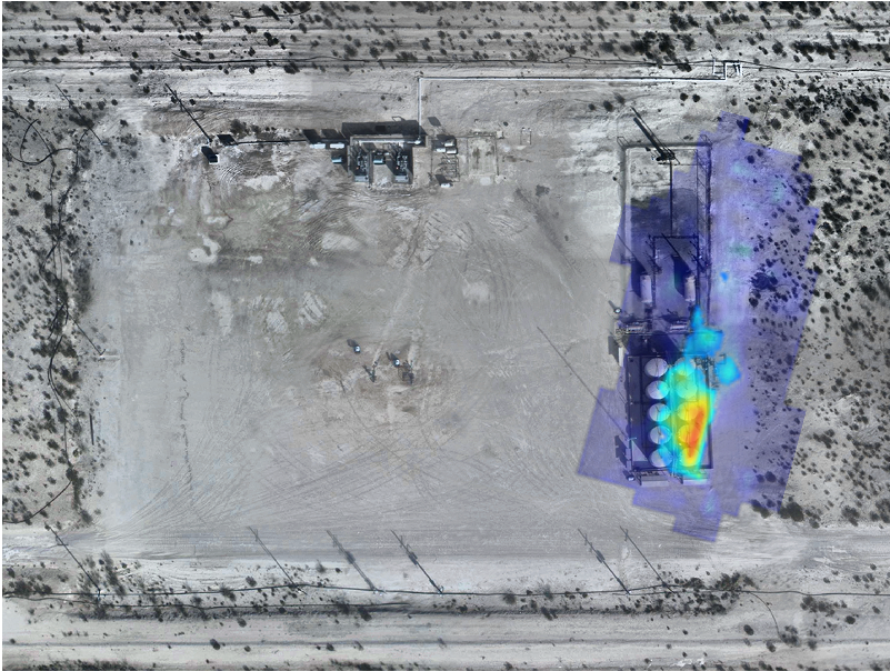
Audit-ready records
Each dataset Bridger delivers includes pinpoint emission sources, georeferenced plume imagery, quantified emission rates, up-to-date aerial photos, and time stamps for complete traceability in audits or investor reporting.
Proven at Scale
With Bridger, precision doesn’t come at the expense of efficiency. Aerially deployed GML can scan hundreds of miles of pipeline in a day, or entire LNG terminals in a matter of days. Unlike some approaches, our lasers operate under a wide array of environmental conditions, so there’s no need to wait for perfect sun angles or calm winds.
This scalability is why operators from production basins to LNG export facilities choose Bridger. Major industry leaders like Chevron, Cheniere, and PG&E all trust Bridger to deliver emissions data and analytics accurate enough for compliance, detailed enough for operations, and credible enough for stakeholders.