Trusted By Industry Leaders


Methane emissions reduction is a tough job, but it doesn’t have to be complicated. Bridger Photonics’ Gas Mapping LiDAR (GML) makes emissions reduction simple.
Bridger’s technology is EPA-approved, extensively third-party validated, and trusted by 9 of the top 10 U.S. natural gas producers. We deliver the industry’s most reliable methane detection, pinpointing specific leak sources, quantifying emissions, and helping operators take action quickly and confidently. Done at scale, our approach captures data for hundreds of production facilities, hundreds of pipeline miles, or a dozen square miles of utility service area daily.
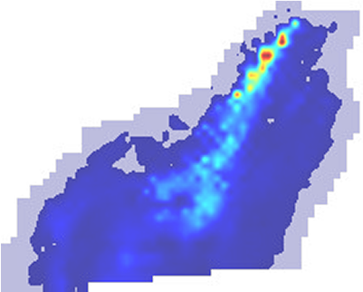
With industry-leading detection sensitivity capabilities and quantitative accuracy, we scan your infrastructure from the air, pinpoint where emissions are coming from, and quantify the size of the leaks. You’ll see every plume in clear, georeferenced imagery, that way you only send crews when and where they’re needed.
-1.png)
Production
GML detects more than 90% of upstream methane emissions efficiently and affordably, keeping more gas in the pipes and reducing emissions. Proprietary analytics filter out off-site interference so you can focus only on leaks you can fix. We offer emissions intelligence to identify trends in leaking infrastructure, aiding in predicting and preventing future emissions.
Midstream
Utilities
Landfill


EPA approved and OGMP 2.0 compatible
Use GML as an alternative technology for OOOOa/b and for OGMP 2.0 Levels 4 and 5.
You decide the sensitivity
Detect down to 1 kg/hr @ 90% probability of detection, or choose from our flexible sensitivity options to match your operational goals.
Your data is scrutiny-proof
It’s third-party tested, auditable, and trusted by leading operators across the natural gas value chain.
Your program becomes scalable and efficient
Save time and money; GML covers hundreds of sites or mile of pipeline per day without disrupting operations or increasing crew exposure.
